Queensbridge Park
Week 35
Hip Hop in Queens
Week 35
Hip Hop in Queens
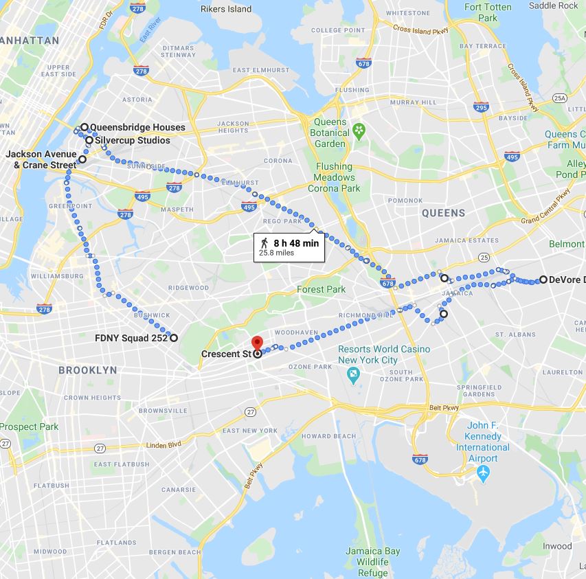
Our second walk focusing on music in NYC takes a look at the history of Hip-Hop in Queens County. From Queensbridge to Corona, from Hollis to Jamaica, Queens native musicians have played a critical role in the development of the form. We'll visit the neighborhood homes of Nas, LL Cool J, Nicki Minaj, A Tribe Called Quest and Kool G Rap, just to name of few. (Note: .4 marathon mileage delta will be made up as we wander)
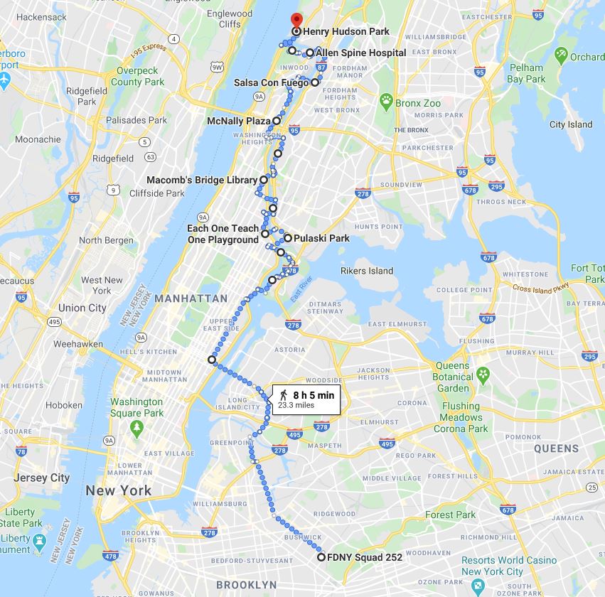
Our walk this week traverses the many bridges that connect Manhattan to all parts east. Starting with the Ed Koch/Queensboro bridge, we snake through Randalls Island before systematically tackling the nine bridges that connect Upper Manhattan to the Bronx. Not included in this map due to route revision constraints are both the walk over the Third Avenue Bridge and the 2.5 miles from Henry Hudson Park to the train at 181st Street.
Week 23
The Queens Coast, Pt. 2
Week 23
The Queens Coast, Pt. 2
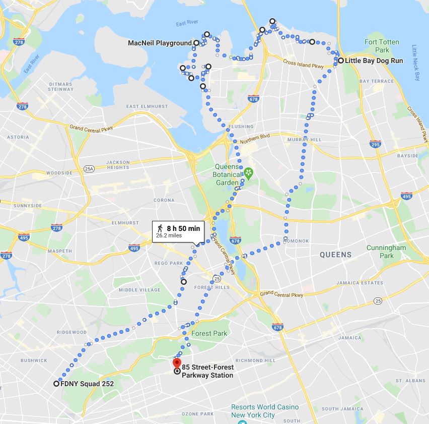
Part two of our Queens coastal conquering starts with a significant hike before we even hit water, crossing through Glendale, Rego Park and the middle of Flushing Meadows Park. We pick up the start of Flushing Bay and reconnect with the East River at College Point, following to Beechhurst and the base of the Throgs Neck Bridge. The return trip takes us through Murray Hill, Forrest Hills and Woodhaven on the way to the J train home.
Week 22
The Queens Coast, Pt. 1
Week 22
The Queens Coast, Pt. 1
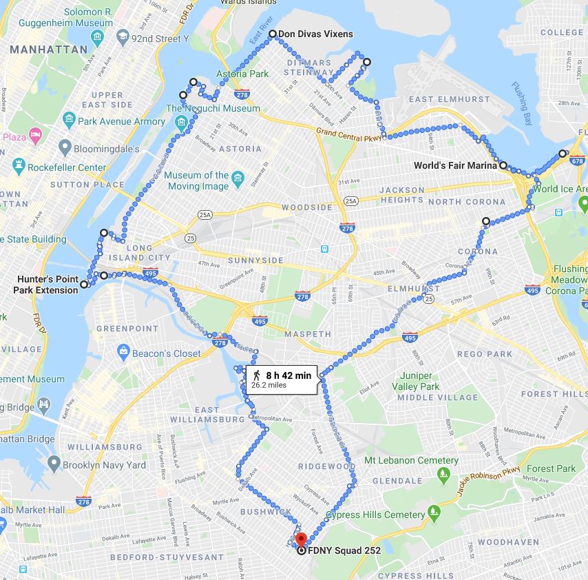
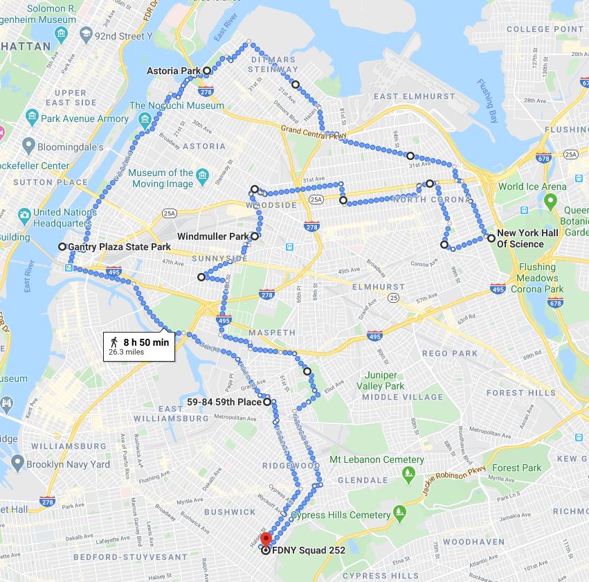
This walk starts a two week quest to tackle the north shore of Queens. Crossing through Blissville, we border Newtown creek before meeting the East River and heading north through Hunters Point, Dutch Kills and Astoria. Taking a right at Ditmars Steinway, we hit the tip of Willets Point and head back down through the meat of the borough.
Our survey of Northwest Queens starts with a walk through Ridgewood, cutting across cemetery territory to walk up the coast of Hunter's Point, Dutch Kills and Astoria. We sweep by LaGuardia airport and tag the New York Hall of Science in Flushing Meadows Park before cutting across Jackson Heights and down through Sunnyside and Maspeth.

