 Back to Tags
Brooklyn Bridge Park
Week 46
In Pursuit of Freedom
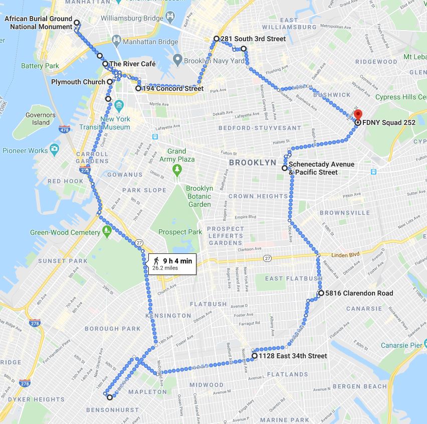
Week 46
In Pursuit of Freedom
In 1790, 61% of all white Households in Kings County owned slaves, representing 30% of the borough's total population. This was enough to earn it the ignominious distinction of "the highest proportion of slaveholders and slaves in the North." Our walk this week covers the grounds of Canarsie and the Flatlands where many of these slaves resided, along with the courageous and vibrant abolitionist history of Brooklyn Heights, Williamsburg and Weeksville. We'll also step into Manhattan to visit the African Burial Ground National Monument near City Hall.
Week 28
Following the BQE
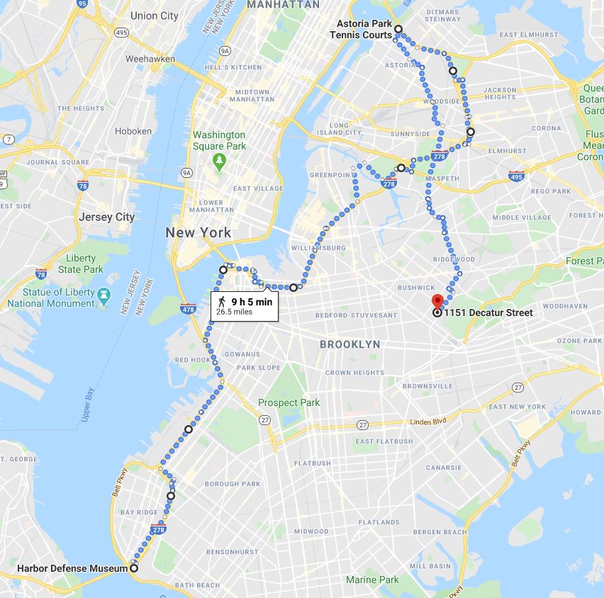
Week 28
Following the BQE
Few major thoroughfares define its surroundings as strongly as the section of I-278 known as the Brooklyn-Queens Expressway. This week we'll follow the entirety of its path, starting at the foot of the RFK bridge in Astoria and concluding at the base of the Verrazzano. Neighborhoods along the way include Woodside, Sunnyside, Williamsburg, Brooklyn Heights, Sunset Park, Bay Ridge and more.
Week 16
The Coast of Brooklyn
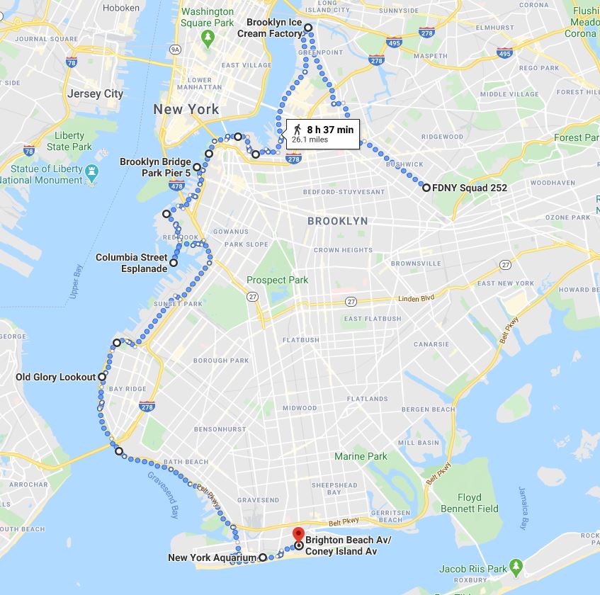
Week 16
The Coast of Brooklyn
If the weather's warm, the shore is where we want to be. This week we look to cover as much BK shoreline in one day as possible. After a hike through inland North Brooklyn, we arrive at the tip of Greenpoint and work our way down the East River, passing all three bridges and crossing the Gowanus Canal. A walk down Second Avenue brings us to Shore Road and the Verrazzanno Bridge. We end the day at Brighton Beach and a long train ride home.
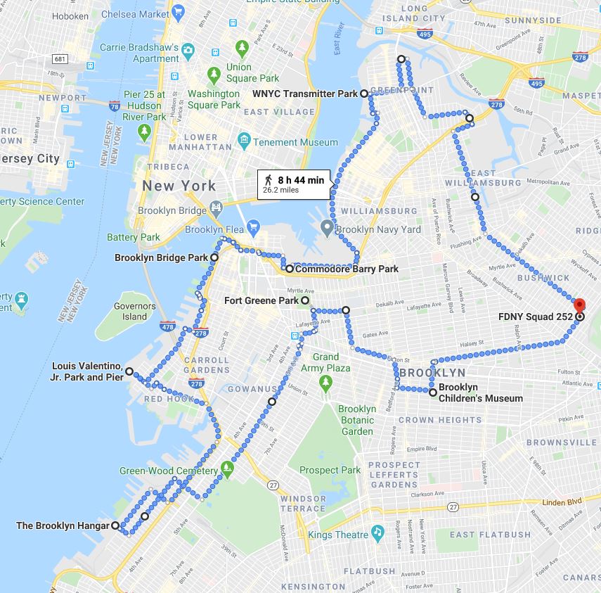
This high-level sweep of North Brooklyn takes us around the edges of Bushwick, Greenpoint, Williamsburg, Brooklyn Heights and Red Hook. We do an about face in Sunset Park and head up 5th Avenue through Park Slope. After briefly touching the tip of Fort Greene, we meander through Bed-Stuy and Crown Heights before heading home.